


A “eureka!” moment can strike any time — on a yoga mat, in the garage, or in the shower — proving that some of the best ideas happen when least expected.
A Window Under the Sea
Virtually Exploring the Ocean Floor
By Fernando Catta-Preta
In Jules Verne’s “Twenty Thousand Leagues Under the Sea,” Captain Nemo shows guests the wonders of the ocean floor through a large, round window on his submarine. It’s a fantastic image and a classic icon from the sci-fi genre, but could a window on a deep-sea vehicle work in real life?
Typically, the answer to that question would be “no” — the water pressure against the external hull of any vessel at extreme depths is too strong for a large window, and special, thick, cone-shaped glass would be needed to prevent a window from being pushed through the steel hull of the submarine. Due to how dark it is in the depths of the ocean, very strong lights and a practical way to clear the area of floating particulate matter would also be necessary. A large circular window with a clear, vivid view of the undersea realm would be nearly impossible to accomplish anywhere outside the confines of Nemo’s fictitious submarine.
But, if you’re an engineer at Northrop Grumman, the answer to that question is “yes.” The team at Dolphin Works — our Annapolis, Maryland, lab — found a way to make it work.
Loading component...
Loading component...
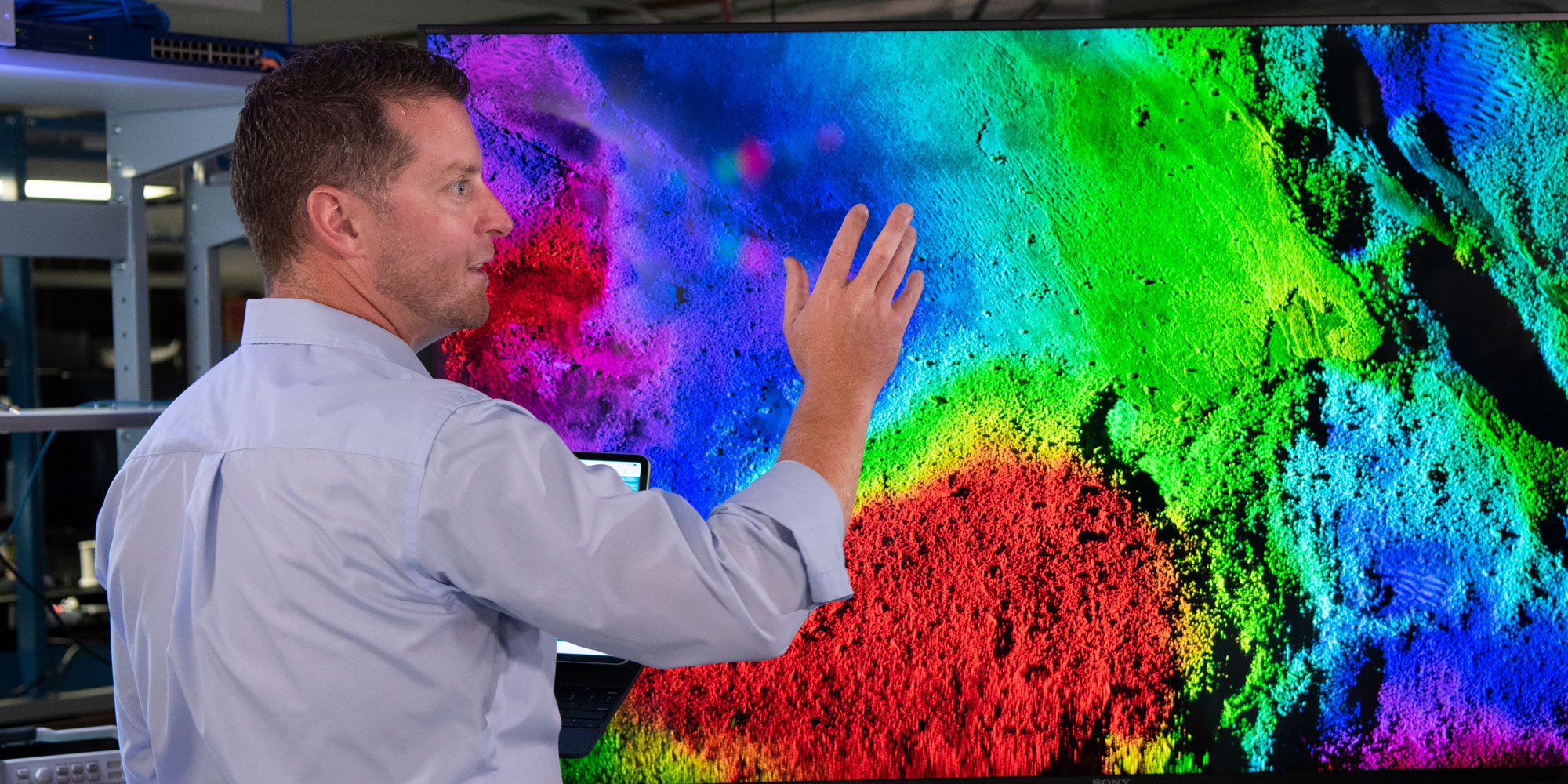
Draining the Ocean
This tech will provide warfighters with a clearer view of the undersea environment around them and support challenging operations where vehicles must navigate within tight tolerances. AI functions, such as automated target recognition, navigation and next generation data processing, will give sailors an incredibly enhanced display of the undersea environment. Using this VR technology to execute missions gives sailors an immediate leg up on adversaries, analyzing potentially dangerous scenarios from a safe distance. Whether looking for dangerous sea mines or searching for new subaquatic species, this system will significantly impact how we explore the ocean floor.
“This is much more than an underwater window,” said Lauren. “It’s like the opportunity to temporarily drain the ocean to explore a shipwreck.”
Learn more about how we’re defining possible at sea, or explore what it’s like to work at Northrop Grumman.

